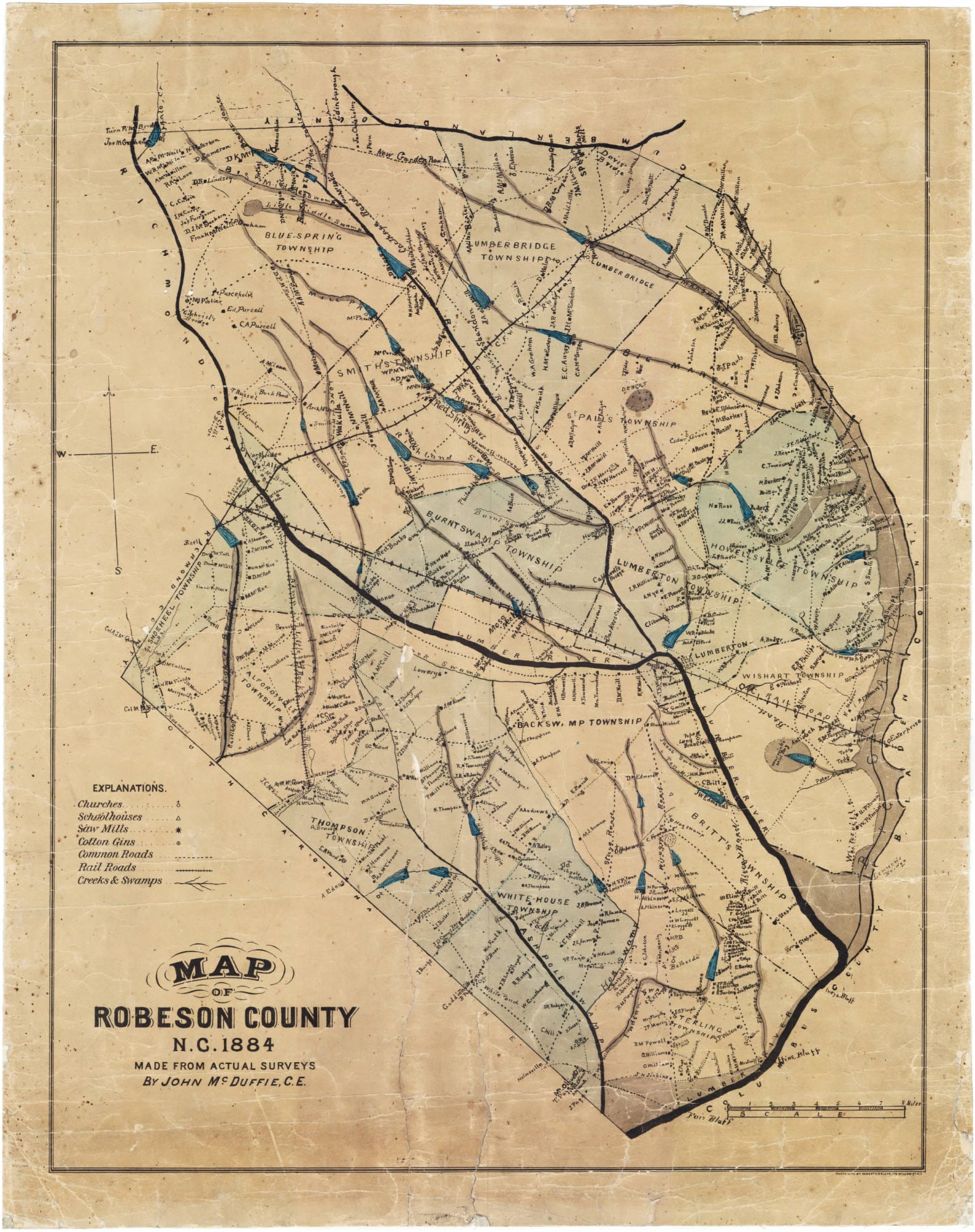
Robeson County, NC: A blend of rich history, diverse communities, and accessible geospatial data empowering residents and researchers alike. This guide unveils the power of Robeson County’s Geographic Information System (GIS), a digital treasure trove of maps, property details, and land records, readily available online. Whether you’re a prospective homeowner, a business owner seeking the perfect location, a researcher delving into the county’s past, or simply a curious resident, this guide will equip you with the knowledge and resources to navigate Robeson County’s digital landscape.
Exploring Robeson County Through GIS
Explore Robeson County’s past, present, and future through interactive GIS maps revealing land ownership, property values, and environmental insights. Imagine exploring the county from the comfort of your home, uncovering property lines, tax information, floodplains, and much more. Robeson County’s GIS makes this possible, providing a wealth of information at your fingertips. This section will guide you through the primary resources and tools available, empowering you to unlock the secrets of Robeson County’s geographic data.
ROKMAPS™: Your Interactive Map of Robeson County
ROKMAPS™ (maps.roktech.net/ROKMAPS_Robeson), developed by ROK Technologies, is the main portal to Robeson County’s GIS data. This user-friendly platform provides regularly updated information, making it an essential tool for anyone seeking current and accurate data. ROKMAPS™ allows you to view multiple map layers simultaneously, offering a comprehensive perspective on the county’s geographic features. Want to see property lines overlaid with zoning information and floodplains? ROKMAPS™ makes it easy.
ArcGIS: Delving into Flood Risk and Parcel Data
ArcGIS (arcgis.com) offers more specialized tools for analyzing geographic data, including valuable flood risk information. While the current flood data on ArcGIS dates back to October 20, 2016, it can still offer valuable insights. However, it’s crucial to acknowledge that flood risks can change over time due to development and weather patterns. Consulting local experts or seeking more recent studies is always recommended for critical decisions. ArcGIS also hosts a map of Robeson County parcels categorized by flood inundation likelihood, providing a valuable layer of information for property research.
Rockford Map Publishers: Precision Parcel Mapping
For the most precise property boundary and ownership information, Rockford Map Publishers (rockfordmap.com) is the gold standard. Their highly accurate parcel maps offer granular detail ideal for legal and real estate professionals. While ROKMAPS™ provides a great overview, Rockford Map Publishers offers the kind of detail a surveyor would need.
Accessing Historical Land Records
Beyond digital maps, accessing historical land records is often essential. The Robeson County Office continues to provide crucial documents like deeds, liens, and titles. These records offer a deeper understanding of a property’s history and legal standing, complementing the information available through GIS platforms. Robeson County Land Records (gathered by CountyOffice.org, an independent entity) may also provide access to these documents.
Understanding Robeson County GIS Data Layers
Unlock Robeson County’s secrets: From land records and parcel data to flood zone maps and soil surveys, discover a wealth of publicly available information. This section explores the key data layers available through Robeson County’s GIS, highlighting their practical applications and potential uses.
Key Data Layers and Their Applications
| Data Layer Category | Examples | Potential Uses |
|---|---|---|
| Property Information | Property lines, ownership details, tax assessments | Real estate transactions, property research, tax inquiries |
| Zoning & Planning | Zoning districts, land use designations, future development plans | Development planning, property development, regulatory compliance |
| Environment & Natural Resources | Floodplains, wetlands, soil types, elevation data | Environmental impact assessments, risk management, conservation planning |
| Infrastructure & Utilities | Roads, bridges, pipelines, power lines | Infrastructure planning, utility management, emergency response |
| Public Safety & Emergency Services | Fire stations, police precincts, emergency shelters | Emergency preparedness, response planning, community safety assessments |
| Demographics & Socioeconomic Data | Population density, income levels, educational attainment | Market research, community development, social service planning |
ROKMAPS™: Your Gateway to Geographic Insights
ROKMAPS™ remains the central hub for accessing these data layers. Its user-friendly interface and regular updates make it an invaluable tool for both casual users and professionals.
Supplementary Data Sources
Beyond ROKMAPS™, several other resources enrich the available data:
- NC State University Libraries: Offers extensive historical data in both vector and raster formats (https://www.lib.ncsu.edu/gis/counties/codata.php?co=37155). This archive allows for a deeper understanding of land use changes over time. Additional URLs for their Vector Data Archive, Raster Data Archive, GIS Website (for questions), and Online Mapping tool are needed for a complete resource.
- RepRisk Geospatial: Integrates environmental, social, and governance (ESG) data with geospatial information (reprisk.com). This is particularly valuable for businesses looking to assess and manage risk.
Data Accuracy and Support
While Robeson County strives for data accuracy, discrepancies can occur. Always double-check information and consider the source’s reliability. If you encounter any difficulties or have questions, online support resources and contact information are available.
The Future of Robeson County GIS
The future of Robeson County GIS is full of potential. Greater integration with other county services, smart city initiatives using real-time data, and more sophisticated geospatial analysis are all possibilities. As technology evolves, the ways we interact with this data will likely become even more integrated into our daily lives. This ongoing evolution suggests that GIS will play an increasingly crucial role in shaping a more sustainable and resilient Robeson County.
Delve into the geographic intricacies of Robeson County GIS for a deeper understanding. Explore similar resources available through the innovative Sanilac County GIS platform.
- Red Cloud, NE: Discover Willa Cather’s Legacy - April 11, 2025
- Remember Old Social Media Sites? Their Rise and Fall - April 11, 2025
- How many days till Feb 3?Accurate Countdowns & Tools - April 11, 2025




2 thoughts on “Accessing Robeson County, NC GIS Data: A Comprehensive Guide to Maps, Property, and Land Records”
Comments are closed.