The Longest River of Mexico: A Journey Through History and Nature
When we think of Mexico, images of sunny beaches, ancient ruins, and delicious cuisine often come to mind. However, it’s crucial to remember the vital role rivers play in shaping the country’s diverse landscape. In Mexico, no river holds more stories than the Lerma-Santiago River System, the longest river entirely within Mexico’s borders.
Spanning over 800 miles—a distance greater than the entire state of California!—the Lerma-Santiago River System winds its way through the heart of Mexico. Its journey begins high in the central highlands, a region renowned for its dramatic mountains and valleys. The Lerma River, the system’s lifeblood, carves a path through this picturesque landscape, eventually pouring into the serene waters of Lake Chapala, Mexico’s largest lake.
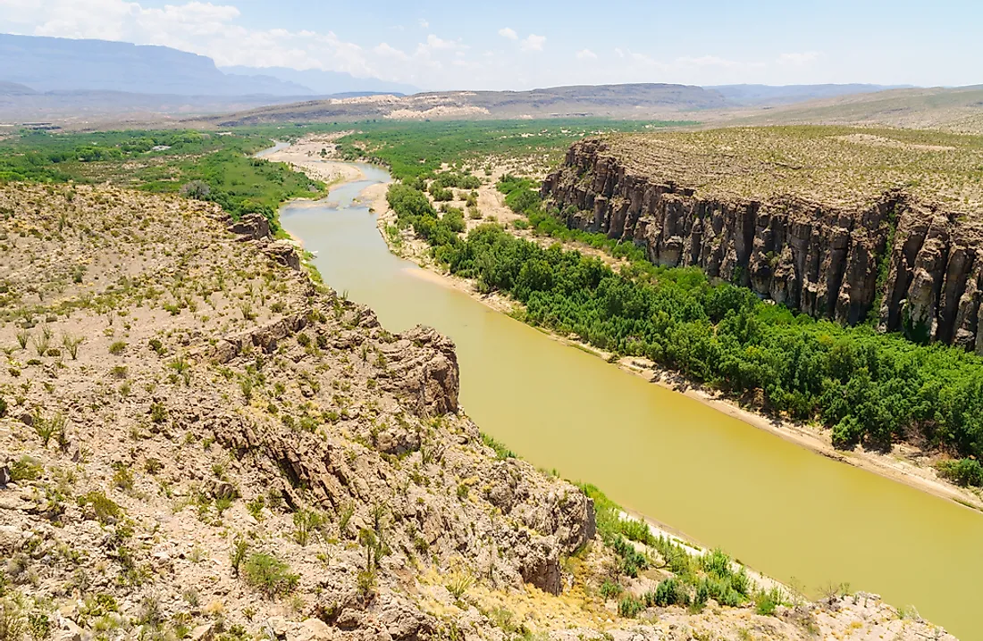
But the journey doesn’t end there. From the depths of Lake Chapala emerges the Santiago River, carrying the waters onward. It cuts through a breathtaking canyon, ultimately reaching its final destination: the vast expanse of the Pacific Ocean. This intricate network, the Lerma-Santiago system, is responsible for draining a significant portion of Mexico, accounting for roughly 6% of its total land area.
Now, many might wonder about the Rio Grande, a river often portrayed in media about the American West. While the Rio Grande does flow through a portion of Mexico, forming a natural border with the United States, a considerable part of its course lies within US territory. The Rio Grande stretches an impressive 1,896 to 1,931 miles (depending on the measurement method), making it significantly longer than the Lerma-Santiago. However, only about 1,250 miles of the Rio Grande actually delineate the border between Mexico and the US.
The Rio Grande’s headwaters lie high in the Rocky Mountains of Colorado. From there, it flows through New Mexico and Texas before finally reaching Mexico. This makes it a critical resource for both countries, supplying water for drinking, agriculture, and industry.
Unfortunately, both the Lerma-Santiago and the Rio Grande face daunting challenges. Pollution stemming from cities and farms, the overuse of water resources, and the looming threat of climate change all jeopardize these essential waterways. Preserving these rivers, and the life they sustain, is a collective responsibility. They are not merely geographical features but threads woven into the very fabric of Mexico’s history, culture, and future.
What Makes the Rio Grande So Long?
The Rio Grande’s impressive length, hugging the border of the US and Mexico, can be attributed to a fascinating combination of geographic factors.
Its journey begins high in the San Juan Mountains of Colorado, at an elevation exceeding 10,000 feet. This high-altitude origin provides a crucial advantage: a consistent source of water. The snow-capped peaks of the San Juan Mountains act like a giant, slow-melting ice cube. As the snow melts, it feeds the Rio Grande throughout the year, ensuring a relatively stable flow.
As the river descends from its mountainous birthplace, it meanders through New Mexico and Texas, gaining length with each twist and turn. Along the way, it’s joined by a network of tributaries – rivers and streams like the Rio Chama, the Rio Conchos, and the Pecos River – all contributing their flow to the Rio Grande’s growing volume.
Unlike some rivers that rush towards the sea, the Rio Grande takes a more leisurely approach, characterized by a surprisingly gentle slope. This slower pace is actually beneficial, as it minimizes erosion along the riverbanks. The Rio Grande’s gentle nature allows it to preserve its form and meander across the landscape for hundreds of miles.
In essence, the Rio Grande’s remarkable length results from a confluence of factors: a high-altitude source providing a consistent flow, a network of tributaries bolstering its volume, and a gradual slope that mitigates erosion. This interplay of geography and hydrology has created one of North America’s longest and most vital rivers. Yet, there’s still much more to discover about the Rio Grande and its intricate relationship with the environment and the people who rely on it.
A Tale of Two Names: Rio Grande vs. Rio Bravo del Norte
The Rio Grande’s dual identity, bearing the names “Rio Grande” and “Rio Bravo del Norte,” provides insight into the river’s storied past.
During the age of exploration, when European explorers were charting the New World, a degree of confusion surrounded the river. Spanish explorers, venturing north, encountered this massive river and named it “Rio Grande,” meaning “Big River” in Spanish.
Concurrently, Mexican explorers, coming from the continent’s interior, had a different encounter. They saw a river that was wild and untamed, characterized by rapids and bends. They called it “Rio Bravo del Norte,” meaning “Wild River of the North.”
Due to the slow transmission of information and the lack of precise maps, these two names persisted, each reflecting a unique perspective on this remarkable waterway.
This duality has defined the river ever since, representing the different ways people have perceived and interacted with this vital resource.
Where Does the Rio Grande Begin and End Its Journey?
Our exploration of the Rio Grande commences in the majestic San Juan Mountains of Colorado, where the river begins its incredible journey. From this lofty origin amidst snow-capped peaks and alpine meadows, it flows for an impressive 1,900 miles, carving its path through Colorado, New Mexico, Texas and finally, Mexico before reaching the Gulf of Mexico.
Along this epic journey, the river traverses through diverse landscapes. Lush forests give way to stark deserts, with vibrant ribbons of riparian zones adding bursts of life and color along the riverbanks. This constant interplay of environments makes the Rio Grande ecologically fascinating.
Beyond its geographical wonders, the Rio Grande holds immense historical significance. For centuries, its waters have witnessed the rise and fall of civilizations, from ancient indigenous peoples to the bustling cities of today. It has shaped borders, influenced geopolitics, and played a vital role in the development of the Southwest.
Today, the Rio Grande’s significance goes beyond its past; it is crucial to the present and future well-being of the entire region. Its vibrant ecosystems support a remarkable array of plants and animals—fish, birds, mammals, and countless other species—that rely on the river for survival. These ecosystems provide food, shelter, and recreational opportunities for communities throughout the region.
However, the Rio Grande faces pressing challenges. Pollution threatens its water quality, climate change brings unpredictable weather patterns impacting water levels, and the increasing demand for water from growing populations strains this precious resource. These complex issues demand careful consideration and a united effort to develop solutions.
Thinking Deeper:
Scientists are actively studying the long-term impacts of climate change on the Rio Grande’s water levels and flow. Some experts suggest that droughts may become more frequent and severe, potentially impacting the entire ecosystem.
Ongoing debate centers around the best ways to manage the Rio Grande’s water resources. Balancing the needs of growing communities with the needs of the environment is a complex challenge.
Researchers continue to discover new plant and animal species along the river, highlighting the incredible biodiversity it supports.
Exploring the Rio Grande is not just about tracing its path on a map; it’s about understanding the intricate connections between the river and the life it sustains. Every new discovery underscores the importance of protecting the Rio Grande for generations to come.
Hello, My love for writing is rivaled only by my passion for in-depth research. While many may skim the surface, I dive deep, seeking the hidden gems of information that give a story texture and depth. Every word I write is backed by hours of exploration, ensuring that my work is not just compelling, but also meticulously accurate. Join me on a journey where every piece is a deep dive into the realms of knowledge and storytelling.