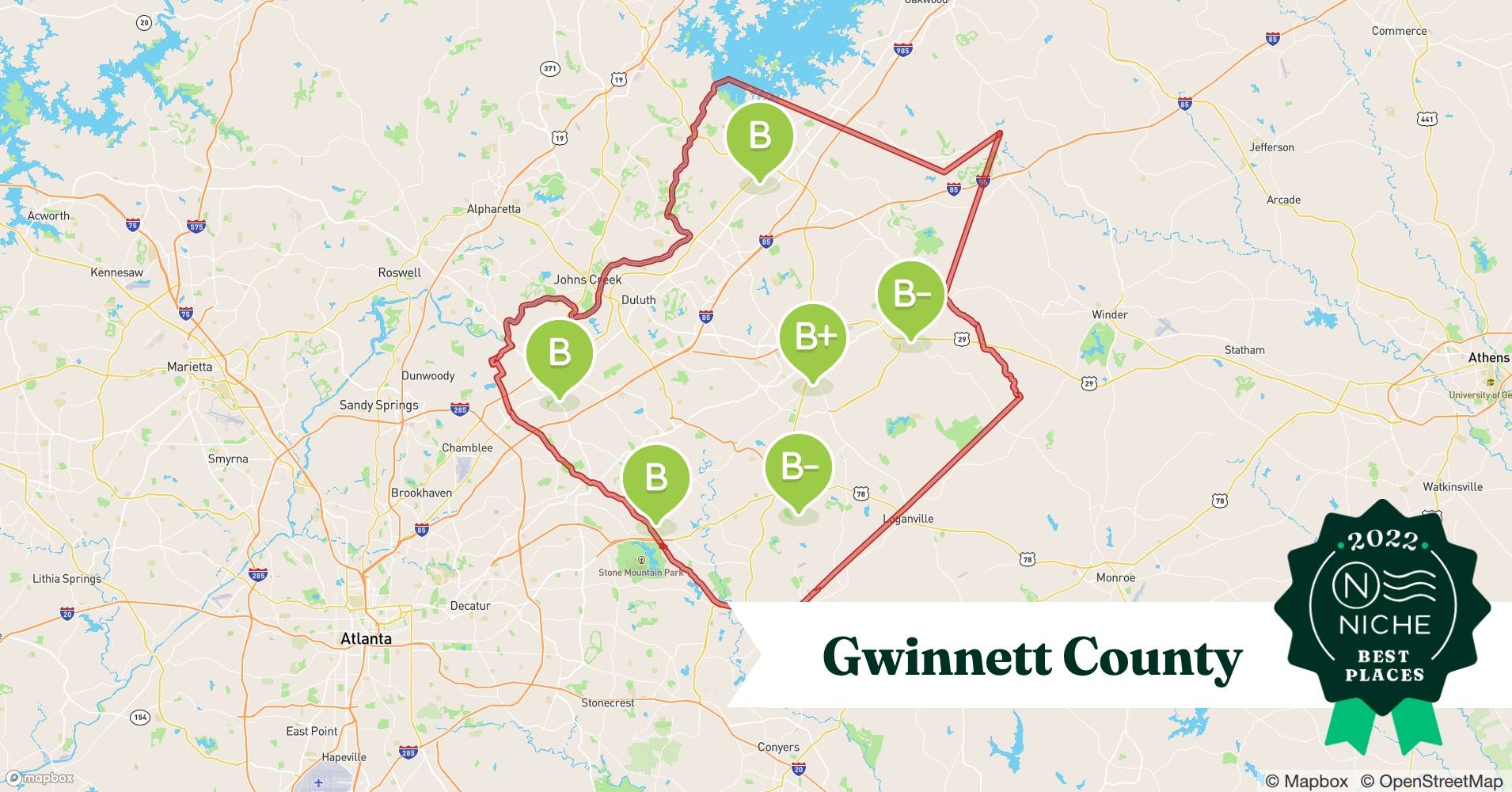
Gwinnett County’s Geographic Information System (GIS) offers a wealth of data, transforming how residents and professionals interact with the county. This comprehensive guide explains how to access and utilize these powerful resources, from interactive maps to downloadable datasets. Whether you’re a homeowner, a business owner, a researcher, or simply curious about your community, this guide will unlock the potential of Gwinnett County’s GIS.
Accessing Gwinnett’s Geospatial Data
Gwinnett County provides several convenient ways to access its GIS data, catering to different needs and technical skill levels.
1. Exploring the Interactive GIS Data Browser
For quick map-based inquiries, the Gwinnett County GIS Data Browser is an invaluable tool. Like an enhanced online map, it requires no specialized software and allows you to easily zoom, pan, and identify features such as property lines, ownership details, streets, addresses, and intersections.
2. Delving into the Open Data Portal
The Gwinnett County Open Data Portal offers a deeper dive into the county’s geospatial data. Here, data enthusiasts and developers can download datasets in various formats, including CSV, KML, Zip, GeoJSON, GeoTIFF, and PNG. API access is also provided via GeoServices, WMS, and WFS links for seamless integration with other applications. The portal also features built-in tools for charting and thematic mapping, enabling direct data analysis.
3. Property Research with Aumentum Tech
For property-specific information, Aumentum Tech’s Property/GIS Search, integrated with the Gwinnett Tax Assessor website, provides a streamlined platform. Users can search by parcel number, owner name, or address to access property details, sales data, and comparable properties. (Further clarification on the relationship between Aumentum Tech and the Tax Assessor website would be beneficial for users).
Gwinnett County GIS Data Coverage and Scope
Gwinnett County’s GIS boasts comprehensive coverage, incorporating high-resolution digital aerial photography and regularly updated base maps. The dataset encompasses over 245,000 tax parcels and 2,300 miles of roadways, providing a detailed view of the county’s landscape.
Key Data Layers
- Tax Parcels: Detailed information on property boundaries, ownership, and assessed values.
- Roadways: Comprehensive street maps, including road names, types, and traffic patterns.
- Aerial Photography: High-resolution images providing a bird’s-eye view of the county’s features.
- Zoning (Potential): While not explicitly mentioned in the initial text, zoning data would be a valuable addition to the GIS offerings, informing users about land use regulations.
- Environmental Data (Potential): Incorporating environmental data, such as wetlands, floodplains, and protected areas, would further enhance the system’s value for researchers and planners.
- Demographics (Discussed Later): Demographic data, including population distribution and characteristics, is explored in a later section, suggesting its potential integration with the GIS.
Practical Applications of Gwinnett County GIS Data
The wealth of data available through Gwinnett County’s GIS has far-reaching applications across various sectors:
Examples of GIS in Action
- Property Analysis: Real estate professionals and homeowners utilize GIS data for property valuations, market analysis, and due diligence.
- Urban Planning & Development: Planners leverage GIS to analyze growth trends, model future development scenarios, and optimize infrastructure development.
- Environmental Management: GIS supports environmental monitoring, resource management, and conservation efforts.
- Public Safety & Emergency Response: First responders utilize GIS to improve response times, locate resources, and coordinate efforts during emergencies.
- Business Development & Site Selection: Businesses use GIS to analyze market demographics, identify optimal locations, and assess potential risks.
- Academic Research: Researchers employ GIS data for spatial analysis, modeling, and understanding geographic patterns.
Gwinnett County GIS: A Look Ahead
Gwinnett County likely plans continuous improvements to its GIS resources, potentially including:
- Enhanced User Experience: Ongoing efforts to improve the usability and accessibility of the platforms.
- Expanded Data Layers: Adding new datasets, such as zoning, environmental data, and real-time traffic information, to enrich the system.
- Integration of New Technologies: Exploring the integration of emerging technologies like 3D modeling and virtual reality to create more immersive experiences.
Free GIS Resources: Expanding Access to Geospatial Tools
Beyond Gwinnett County’s specific offerings, a range of free GIS resources are available to the public:
Free GIS Software Options
- Desktop Applications: Powerful free and open-source software (FOSS) like QGIS, GRASS GIS, and gvSIG offer comparable functionality to commercial alternatives. Specialized options include WhiteboxTools (command-line geoprocessing).
- Mobile GIS: Free mobile GIS apps, including limited versions of commercial platforms like ArcGIS Online, enable geospatial work on the go.
Free Online GIS Platforms
Web-based platforms like ArcGIS Online (public accounts) and Google Earth Engine offer free access to tools for web mapping, data visualization, and basic spatial analysis, and may have usage limits.
Free GIS Data Sources
Data is crucial for any GIS project and many sources offer free geographic information:
- OpenStreetMap: A global, community-driven map providing free vector data for roads, buildings, and other features.
- USGS Earth Explorer: Access to satellite imagery and aerial photos from the United States Geological Survey.
- Natural Earth Data: Global vector and raster datasets suitable for small-scale mapping.
- Local Government Portals: Many local governments provide free access to their GIS data, often including parcel data, zoning information, and street networks.
Understanding “Free” in the GIS Context
“Free” GIS resources may take different forms:
- Open Source: Software with freely available source code allowing for customization and modification.
- Freemium: Software offering basic features for free, with paid options for advanced functionality or increased storage.
Navigating the Free GIS Learning Curve
Free GIS software often has a steeper learning curve, but abundant online tutorials, documentation, and supportive user communities make the task easier.
What is GIS in Georgia?
Geographic Information Systems (GIS) in Georgia, and specifically Gwinnett County, connect information to location. It’s a powerful tool that goes beyond simply asking “where” to explore “why” things are located in specific places. Gwinnett County’s readily accessible GIS data, ranging from property lines and roads to aerial photos, empowers residents, businesses, and government officials alike.
Gwinnett County’s Diverse Demographics
Gwinnett County exemplifies a diverse community, with no single racial majority. White residents comprise an estimated 33.8%-39.43%, followed by Black or African American residents (27.1%-28.46%), Asian residents (around 12.7%), Hispanic residents (9.14%-11.1%), and Multiracial residents (up to 9.3%). These figures are subject to change as new data emerges.
The uneven distribution of racial groups across the county is likely influenced by various factors and warrants further investigation into its effects on access to resources and community development. Furthermore, it’s important to acknowledge the rich diversity within each broad racial category.
Comparing Gwinnett County GIS with Neighboring Counties
A comparison of Gwinnett County’s GIS offerings with those of neighboring counties would be a valuable addition to this guide. This analysis could highlight best practices, identify areas for potential improvement, and provide context for Gwinnett County’s progress in the field of GIS. This research would provide valuable insights for both residents and officials.
Conclusion
Gwinnett County’s GIS provides a wealth of information, empowering residents and professionals alike. By understanding how to access and utilize these resources, you can gain valuable insights into your community, make informed decisions, and contribute to a better understanding of Gwinnett County. This guide serves as a starting point for exploring the power of GIS, and we encourage you to delve deeper into the available datasets and discover the many ways they can benefit you.
Internal links provided:
Fluvanna County GIS
Cowlitz River fishing report
- Revolution Space: Disruptive Ion Propulsion Transforming Satellites - April 24, 2025
- Race Through Space: Fun Family Game for Kids - April 24, 2025
- Unlocking the Universe: reading about stars 6th grade Guide - April 24, 2025


