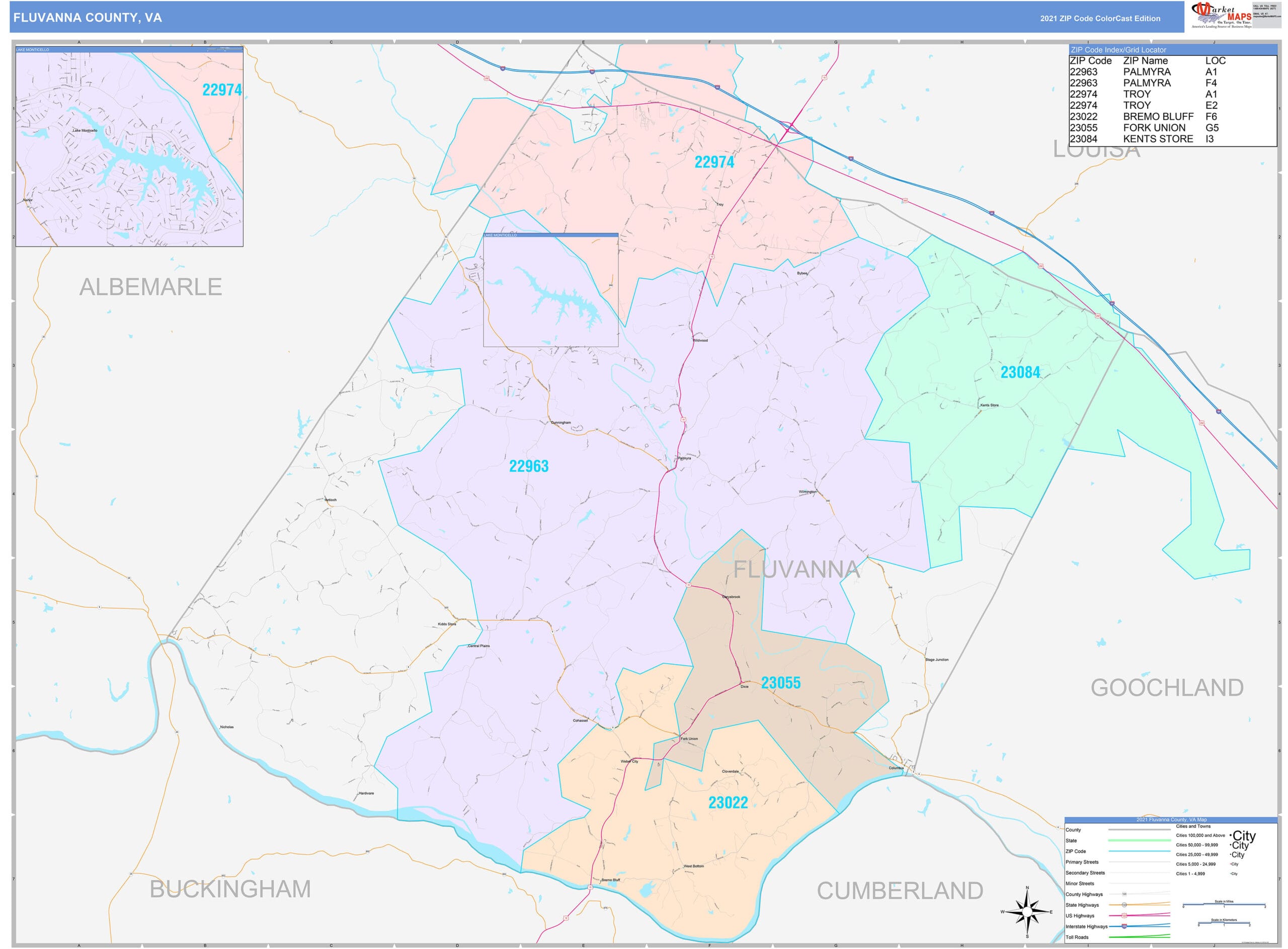
Access Fluvanna County’s comprehensive GIS data: Explore interactive maps, property records, tax information, and environmental data. This guide unlocks the power of Fluvanna GIS, providing a comprehensive resource for residents, businesses, and researchers. Navigate Fluvanna County with ease using GIS: Discover property boundaries, zoning regulations, and public land surveys for informed decision-making. Whether you’re buying property, conducting research, or simply curious about your neighborhood, this guide will equip you with the knowledge and tools to navigate Fluvanna with the click of a button.
Discovering Fluvanna County Through GIS
Curious about Fluvanna County? Whether you’re a prospective homeowner, a business entrepreneur, or a researcher, Fluvanna County’s Geographic Information System (GIS) offers a wealth of valuable data. This guide provides a step-by-step walkthrough of Fluvanna’s GIS resources, using clear, everyday language.
Accessing Fluvanna’s GIS Data
Fluvanna’s GIS data is readily accessible online. Here’s a breakdown of the key resources:
Official Fluvanna County Resources
- Fluvanna County Website: The official website (https://www.fluvannacounty.org/planning/page/geographic-information-systems) is your central hub. It provides interactive maps with layers for streets, zoning, tax maps, parcel information, and more. You can also submit data requests here.
- Vision Government Solutions: For in-depth property assessments and physical characteristics, visit https://gis.vgsi.com/fluvannacountyva. Note that this data is updated biennially, so some details may not be entirely current.
Third-Party GIS Resources
- WebGIS: https://www.webgis.net/va/fluvanna combines government and private data, offering a broader perspective. Important Note: WebGIS data should not replace a professional land survey.
- County Office: https://www.countyoffice.org/va-fluvanna-county-gis-maps specializes in environmental records, city maps, and public land surveys.
Navigating the Fluvanna County WebGIS Portal
The Fluvanna County WebGIS portal (https://www.webgis.net/va/fluvanna) is your primary gateway to the county’s geospatial data.
A Step-by-Step Guide
Accessing the Portal: Visit the Fluvanna County WebGIS website.
Exploring the Interface: Familiarize yourself with the map interface, including zoom, pan, and basemap controls.
Selecting Data Layers: Choose the data layers relevant to your needs (e.g., zoning, topography).
Querying Features: Click on map features for detailed information (e.g., parcel owner, street name).
Downloading Data: Download data in formats like .gdb and .shp for offline use (coordinate system: NAD 1983 VA State Plane South (feet)). A built-in Help/User Guide is available for assistance.
Types of GIS Data Available
Fluvanna County’s GIS data encompasses a wide range of information:
- Property Boundaries: Determine the exact outlines of land parcels.
- Zoning Regulations: Understand permitted land uses in different areas.
- Tax Assessments: Access property tax information.
- Environmental Features: Identify wetlands, floodplains, and other environmental factors.
- Infrastructure: View roads, utilities, and other infrastructure data. This includes layers for streets and addresses, aerial photography, topography, voting districts, and more.
Real-World Applications of Fluvanna GIS
GIS data supports informed decision-making in various scenarios:
- Homeowners: Assess flood risks, property details, and neighborhood characteristics.
- Businesses: Identify optimal locations, analyze market demographics, and plan development projects.
- Researchers: Conduct environmental studies, demographic analysis, and land use change assessments.
- Community Planners: Design infrastructure improvements and manage resources effectively.
Comparing Fluvanna County GIS Data Sources
| Data Source | Strengths | Limitations |
|---|---|---|
| Fluvanna County Website | Official, comprehensive, accessible | May require data requests, less user-friendly |
| Vision Government Solutions | Detailed property assessments | Biennial updates |
| WebGIS | Combines multiple sources, broader perspective | Not a substitute for a professional land survey |
| County Office | Focus on environmental and survey records | May have fewer features |
The Future of Fluvanna GIS
Fluvanna County is committed to enhancing its GIS capabilities. Future developments may include more detailed maps, improved visualization, real-time information, and potentially 3D mapping. These advancements suggest an evolving landscape of information, offering richer insights into Fluvanna County. Ongoing research and data collection methods could further refine the precision and detail of available data.
Contact Information
For further inquiries, contact the Fluvanna County Planning Department via the County website.
Explore other robust GIS systems, such as Henrico VA GIS and the innovative Hoke County GIS. Remember, while GIS data is a valuable tool, it’s essential to acknowledge its limitations and use it responsibly, considering potential biases or inaccuracies. By leveraging Fluvanna County’s GIS resources, you gain access to a powerful toolkit for understanding and navigating the county’s landscape.
- Revolution Space: Disruptive Ion Propulsion Transforming Satellites - April 24, 2025
- Race Through Space: Fun Family Game for Kids - April 24, 2025
- Unlocking the Universe: reading about stars 6th grade Guide - April 24, 2025


