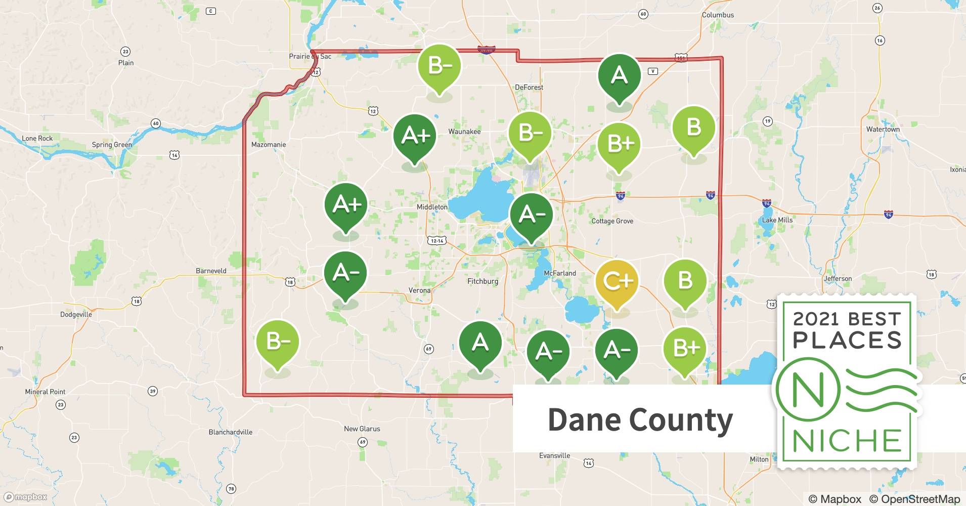
Dane County, Wisconsin, home to Madison, the state’s vibrant capital, thrives on a unique blend of urban sophistication and natural beauty. But beneath the surface lies a powerful tool shaping the county’s growth and management: Geographic Information Systems (GIS). From planning new parks to tracking environmental changes, GIS provides the data-driven insights that inform decisions big and small. This guide unveils how Dane County leverages GIS, offering practical examples and resources for residents, businesses, and researchers alike. Discover how you can tap into this wealth of information, whether you’re a tech whiz or simply curious about your neighborhood.
Unlocking Dane County’s Data Treasures
So, what exactly is Dane County, WI GIS? It’s a digital treasure trove of maps and data layered with information about virtually everything in the county—from property lines to soil composition. While it may sound technical, accessing and using this data is surprisingly straightforward. This guide will walk you through the key resources—DCiMap, the Land Information Office, and the power of ArcGIS—and empower you to make the most of this powerful tool.
Navigating Dane County with DCiMap
Imagine a supercharged Google Maps tailored specifically for Dane County. That’s essentially what DCiMap is. Powered by Esri’s industry-standard ArcGIS software, this interactive mapping platform provides a one-stop shop for exploring a vast array of geographic data, including zoning regulations, wetland locations, and even details about the county’s infrastructure.
DCiMap isn’t just about viewing maps; it’s about interacting with them. Zoom, pan, toggle layers, and even create custom maps tailored to your specific needs. Curious about proposed developments near you? Overlay development plans with environmental data to visualize potential impacts. Need to print property boundaries for a community project? DCiMap makes it possible. You can even download the raw data for your own analysis.
The Land Information Office (LIO): Your GIS Library
Consider the Land Information Office (LIO) the central repository for all things geospatial in Dane County. Various county departments contribute data to the LIO, creating a comprehensive collection of geographic information, from property records and tax assessments to detailed maps of roads, utilities, and public spaces. Much of this data is publicly available for download directly from the LIO website. Need historical aerial photographs to track neighborhood changes? The LIO probably has them. This resource empowers researchers, businesses, and residents to tap into a wealth of information for a multitude of projects.
GIS in Action: The Land & Water Resources Department
For a real-world example of Dane County GIS in action, look no further than the Land & Water Resources Department. They heavily rely on DCiMap and other GIS tools for managing and protecting the county’s natural resources. Imagine trying to track watershed health or plan flood mitigation strategies without spatial information—it would be nearly impossible! GIS provides the power to visualize complex environmental data, analyze trends, and make informed decisions about land use, water quality, and conservation efforts.
Pedal Power: The Low Stress Bicycle Route Finder
Dane County’s commitment to GIS extends beyond the purely practical. The Low Stress Bicycle Route Finder perfectly illustrates how complex data can transform into a user-friendly tool benefiting everyone. This interactive tool uses spatial data to help cyclists find the safest and most enjoyable routes, eliminating the guesswork of navigating busy roads. It’s a testament to Dane County’s innovative use of GIS to enhance quality of life.
The Power of ArcGIS: The Engine Under the Hood
Dane County’s GIS system is built upon Esri’s ArcGIS, a leading global GIS technology platform. This is crucial for ensuring data accessibility and compatibility with a wide range of other tools and systems. ArcGIS offers sophisticated tools for analysis, visualization, and data management, enabling professionals and researchers to perform deep dives into spatial data, including advanced modeling and sophisticated analysis.
| Resource | Description |
|---|---|
| DCiMap | Interactive mapping application |
| Land Information Office (LIO) | Central source for GIS data downloads and information |
| Land & Water Resources | Example of how GIS is used for resource management |
The Future of Dane County GIS: A Glimpse Ahead
The world of GIS is constantly evolving, and Dane County is likely at the forefront of these advancements. Imagine 3D modeling for immersive visualizations of proposed developments, real-time data feeds optimizing transportation planning, or LiDAR technology creating incredibly detailed terrain models. These possibilities could revolutionize how the county manages resources, plans for the future, and engages with the community.
Beyond the Map: Discovering What Dane County, Wisconsin is Known For
Dane County, Wisconsin, is much more than just its bustling capital city, Madison, though the city’s vibrant energy significantly shapes the county’s identity. It’s a place where urban meets rural, technology intersects with tradition, and innovation thrives alongside natural beauty.
Unveiling Dane County’s Hidden Gems
While Madison, with its State Capitol building, the University of Wisconsin-Madison, and a thriving downtown, is a focal point, Dane County extends far beyond the city limits. Charming towns like troll-adorned Mount Horeb and Norwegian-influenced Stoughton add to the rich tapestry of the county. These communities offer a glimpse into a slower pace of life, a strong connection to the land, and a sense of community that complements Madison’s urban energy.
A Nature Lover’s Paradise
From kayaking on the sparkling waters of Lake Mendota and Lake Monona to hiking through verdant forests and cycling along scenic trails, Dane County offers a wealth of natural beauty. Its abundant lakes, parks, and protected lands provide a haven for outdoor enthusiasts. The county’s commitment to environmental stewardship ensures these landscapes will be enjoyed for generations to come.
Dane County: A Tech-Savvy Region
Dane County is a leader in GIS technology, offering comprehensive mapping data to residents and professionals. This forward-thinking approach to data accessibility has become a hallmark of the county, empowering everyone to access and analyze geographic information. Uncover the secrets behind the cville zip code and unlock a world of fascinating information about this unique area. Delve into the rich tapestry of the effingham il zip code and discover the hidden gems within this captivating locale.
A Quick Guide to Dane County’s GIS Resources
- Finding Property Lines: The Dane County Parcel Viewer website allows you to enter an address or parcel number to view property boundaries.
- Accessing Aerial Imagery: Dane County’s online mapping tools allow you to view historical aerial photographs.
- Researching Environmental Impact: Explore Dane County’s environmental data layers to better understand potential impacts on your area.
Navigating Growth and Innovation: Dane County’s Future
Dane County is constantly evolving. A growing tech sector complements its established strengths in government and education. However, this growth presents challenges, particularly in managing expansion sustainably and ensuring affordability amidst prosperity. The interplay of urban and rural, tradition and innovation, will shape Dane County’s future.
Dane County’s Geographic Tapestry
Dane County boasts a diverse landscape. Fertile prairies give way to rolling hills and tranquil woodlands. The Yahara River connects the four lakes—Mendota, Monona, Waubesa, and Kegonsa—which play a vital role in recreation and the local climate. Rich soil supports a thriving agricultural tradition. This dynamic interplay of land and water shapes the lives of its residents.
Dane County is Wisconsin’s second-most populous county, with over half a million residents. Madison, the state capital, is a hub of activity fueled by government operations, the University of Wisconsin-Madison, and a rich cultural scene. Smaller towns and rural communities contribute to the county’s unique character. A network of roads, highways, and bike paths connects these communities, fostering interconnectedness.
Dane County leverages technology to make geographic information readily accessible. Interactive GIS mapping tools, like the Low-Stress Bicycle Route Finder and the Dane County Parcel Viewer, empower residents, businesses, and researchers. These tools transform complex data into user-friendly resources.
Using Dane County’s GIS Resources: Practical Examples
- Finding Property Lines: Access the Dane County Parcel Viewer, enter the address or parcel number, and view the property boundaries.
- Accessing Aerial Imagery: Navigate to the aerial imagery layer on the Dane County GIS mapping portal.
- Researching Environmental Impact: Explore the available environmental data layers within the Dane County GIS system.
These are just a few examples. Some researchers are exploring new applications for this data. While the current information is extensive, ongoing research suggests the potential of Dane County’s GIS resources continues to expand.
Dane County WI Property Taxes: Understanding Rates, Assessments & Appeals
Navigating Dane County’s property tax system can be complex. There’s no single county-wide rate. Let’s break down the key elements.
Key Points:
- No Uniform Rate: Rates vary by location.
- Mill Rate + Assessed Value = Your Tax: The mill rate is multiplied by your property’s assessed value.
- Median Rate as a Guide: The median effective tax rate is around 1.80%, resulting in a median annual tax bill of $4,149 for a $230,800 home.
- Parcel Search is Crucial: Use the Dane County Parcel Search for property-specific details.
Why the Variation in Rates?
Different areas have different needs and costs. Each municipality and school district sets its own mill rate, reflecting local budget requirements.
The Median Rate: A Starting Point
The 1.80% median effective rate provides a benchmark, slightly higher than the Wisconsin state average of 1.59%. It’s a general overview, not your specific rate.
Finding Your Property’s Rate
The Dane County Parcel Search website is your personalized property tax portal.
Deciphering Your Tax Bill
Your tax bill includes Total Taxes, Lottery Credit, First Dollar Credit, Special Assessments, and Special Charges. Net Property Taxes are calculated by subtracting credits from Total Taxes. Adding Special Assessments and Charges gives the final amount.
Understanding Mill Rates
Mill rates are set by various taxing entities to fund their budgets. Understanding these levies offers a fuller picture of your tax calculation.
Appealing Your Assessment
If you believe your assessment is inaccurate, you have the right to appeal.
The Dynamic Tax Landscape
Property values and tax burdens fluctuate. Staying informed about local real estate trends can provide insight into potential future tax directions.
Uncertainty and Future Trends
Predicting future rates is challenging due to various influencing factors. While the current median rate offers a snapshot, ongoing research is needed for a clearer long-term picture. Some experts suggest growth could lead to higher rates, while others believe spending controls could mitigate increases.
By understanding these factors, you’re better equipped to manage your property taxes effectively. Remember, the Dane County Parcel Search and County Treasurer’s office are invaluable resources.
- 1 Liter to Fluid Ounces: Easy Conversion Guide - April 9, 2025
- Unlock what is the seventh month: A Cross-Cultural Calendar Guide - April 9, 2025
- Discover White Fruits: Ultimate Guide to Taste & Nutrition - April 8, 2025


2 thoughts on “Accessing and Downloading Dane County, WI GIS Data: A Comprehensive Guide”
Comments are closed.