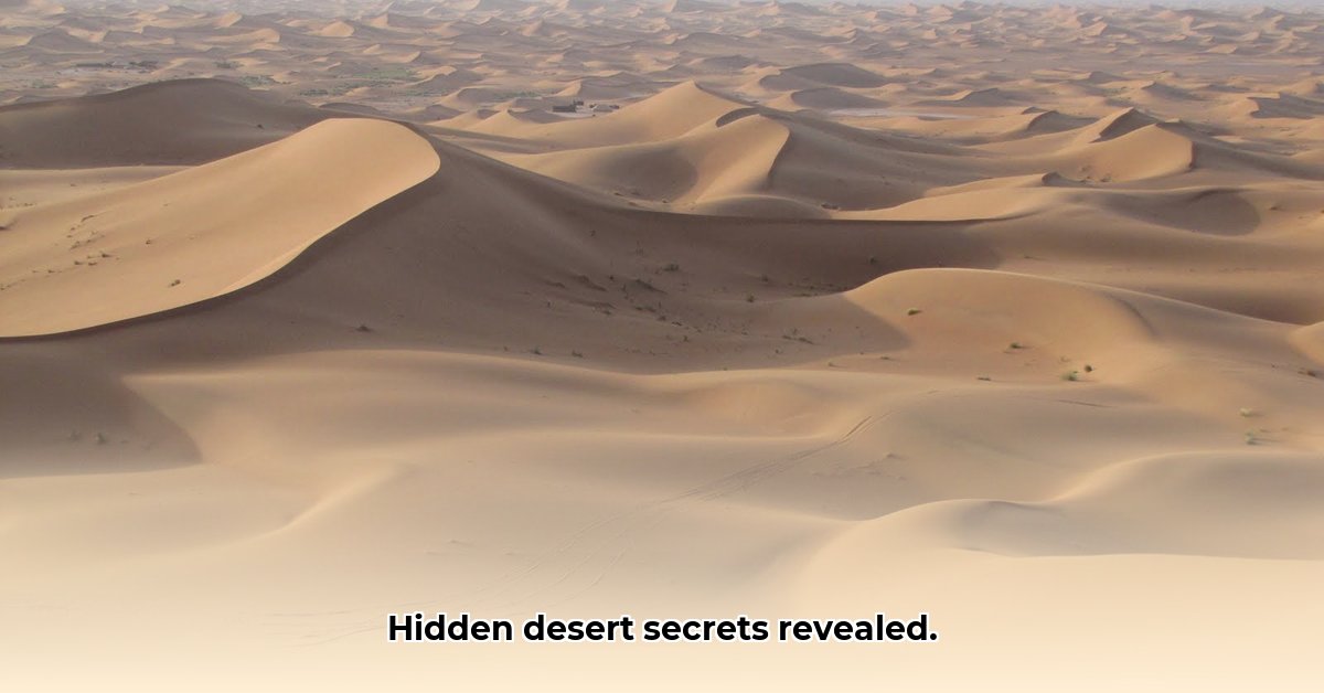
Beyond the Dunes: Unveiling the True Face of the Desert
The word “desert” often conjures images of endless, undulating sand dunes. While visually captivating, this imagery only scratches the surface of the diverse and complex geological tapestry that defines these arid landscapes. Far from monotonous expanses of sand, deserts encompass a rich mosaic of exposed bedrock, gravel plains, and dry clay surfaces. In fact, these features often dominate, comprising up to 80% of desert terrain. Learn more about desert ecosystems here. This article embarks on a journey into the heart of desert geology, exploring the surprising diversity of these ecosystems and the powerful forces that sculpt them.
Deserts are dynamic environments shaped by the relentless interplay of aridity, wind erosion, and extreme temperature fluctuations. These factors contribute to a striking array of landforms, from the expansive, flat rocky plateaus known as hammadas to the rolling gravel plains called serirs and the iconic sand dunes.
The seemingly simple question of desert sand’s origin unveils a fascinating geological narrative. The journey often begins hundreds, even thousands, of miles away, in distant mountains and plateaus. Rivers act as conveyor belts, transporting weathered rock fragments, minerals, and organic matter downstream. As these rivers reach arid regions and evaporate, the transported sediment is deposited. Wind then takes over, further refining and sorting these materials, sculpting them into the majestic sand dunes that characterize parts of many deserts.
Each grain of sand holds a wealth of information. While quartz is a common component, desert sand also comprises fragments of other rocks, minerals like feldspar, and even microscopic fossils. This composition provides a window into the desert’s geological past, potentially revealing ancient shorelines or long-vanished river systems. Analyzing grain size and shape offers further insights into the processes that have shaped the landscape. Fine-grained sand suggests long-distance transport by wind or water, while coarser grains indicate shorter journeys. The degree of sorting, or the similarity in grain size, provides clues about the stability of the depositional environment. Well-sorted sand suggests a stable setting, while poorly-sorted sand indicates a more dynamic environment.
Decoding the Secrets of Sand: Advanced Analytical Techniques
Understanding desert geology extends beyond observation; it requires delving into the microscopic realm. Analyzing desert sand provides invaluable insights into a region’s geological history and the processes that have shaped it. While traditional methods like sieving have long been used to analyze grain size distribution, modern technology offers significant advancements. Digital image analysis software, such as ImageJ, and emerging AI-powered tools are revolutionizing the field. These tools enable geologists to analyze vast quantities of sand grains with unprecedented speed and accuracy, providing statistically robust data for comprehensive analysis.
Large-scale datasets, such as those gathered from extensive studies of deserts like the Taklamakan in China, are providing unparalleled insights into the long-term evolution of these dynamic landscapes. By combining these advanced analytical techniques with field observations and other geological data, scientists are piecing together a more complete understanding of desert formation, evolution, and the complex interactions between geology, climate, and ecology.
A Sustainable Future: Desert Resource Management in a Changing World
Deserts, often perceived as barren wastelands, are in reality ecosystems with untapped potential for sustainable development. However, realizing this potential requires innovative approaches to resource management, especially in the face of climate change. By unraveling the intricate relationships between geology, climate, and ecology, we can develop strategies for desert reclamation, responsible resource use, and ecosystem preservation.
Desert soils, often rich in minerals and other elements, present unique opportunities for agriculture. Careful analysis of soil composition can guide the selection of suitable plant species that can thrive in arid conditions. For instance, volcanic minerals can enrich the soil, providing essential nutrients for plant growth and paving the way for sustainable agriculture in these challenging environments. Integrating sustainable agricultural practices, such as developing drought-resistant crops and optimizing irrigation techniques, is crucial for ensuring food security and enhancing livelihoods in desert communities.
Understanding the influence of wind and water is paramount for effective desert management. Wind plays a crucial role in shaping dunes, while water, even in limited amounts, carves canyons and replenishes vital underground aquifers. Technological advancements, such as the use of drones for mapping and monitoring, are revolutionizing desert management by providing detailed information and enabling more efficient resource allocation. However, addressing the cost and accessibility of these technologies is essential for widespread adoption.
Successful desert management hinges on collaboration. Scientists, local communities, governments, and private sectors must work together, sharing knowledge and resources to ensure the long-term sustainability of these valuable ecosystems. Through collaborative efforts and innovative solutions, we can unlock the hidden potential of deserts and ensure their preservation for future generations.
Forecasting Shifting Sands: Predicting Dune Movement with Modern Tools
Predicting sand dune movement is crucial for sustainable land management in desert regions. Traditional methods, often based on historical observations and limited on-the-ground measurements, face limitations in accuracy and scope. However, the convergence of machine learning (ML) and remote sensing technologies is transforming our ability to forecast the dynamic behavior of these shifting landscapes.
Remote sensing, using satellite imagery and aerial photography, provides a comprehensive view of vast dune fields, allowing scientists to monitor changes in dune morphology and track movement patterns over time. Machine learning algorithms, such as Convolutional Neural Networks (CNNs, e.g., SandUnet, MobileNet) and Support Vector Machines (SVMs), are then employed to analyze these extensive datasets, identifying patterns and predicting future dune migration. These algorithms can be trained to recognize and classify different types of dunes, further refining prediction accuracy.
While these technologies offer powerful tools, challenges remain. Prediction accuracy depends on several factors, including the chosen algorithm, the quality of the training data, the complexity of the dune field, and the influence of external factors like wind patterns, precipitation, and vegetation cover. Integrating multiple data sources, including meteorological information, ground-based measurements, and high-resolution satellite imagery, is essential for enhancing prediction accuracy and developing robust models for managing the dynamic nature of desert landscapes.
Hello, My love for writing is rivaled only by my passion for in-depth research. While many may skim the surface, I dive deep, seeking the hidden gems of information that give a story texture and depth. Every word I write is backed by hours of exploration, ensuring that my work is not just compelling, but also meticulously accurate. Join me on a journey where every piece is a deep dive into the realms of knowledge and storytelling.