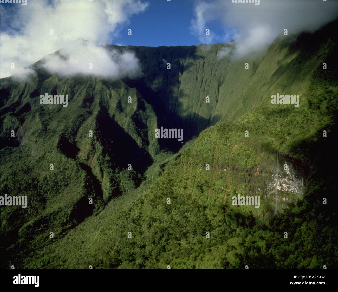
Waialeale: A Hawaiian shield volcano shrouded in perpetual mist, harboring a unique ecosystem teeming with rare life. More than just rain, Waialeale’s 5,148-foot summit creates a microclimate influencing Kauai’s weather and biodiversity. Reaching Waialeale offers a challenging but rewarding trek through the Alakaʻi Wilderness Preserve, home to breathtaking views and delicate flora. The “rippling water” of Waialeale continues to fuel debate about its claim as Earth’s wettest spot, with historical rainfall data varying widely.
A Realm of Mist and Rainfall
Waialeale, nestled within Kauai’s Alakaʻi Wilderness Preserve, is the second highest point on the “Garden Isle.” This shield volcano, reaching 5,148 feet, is a realm of mist and rainfall, perpetually veiled in clouds. Its Hawaiian name, meaning “rippling water” or “overflowing water,” speaks to its nature. The mountain’s persistent rainfall shapes not only the physical landscape, but also the cultural and ecological significance of the area. It has historically been revered as a sacred site by Native Hawaiians, a place of pilgrimage for chiefs and priests seeking connection with Kāne, the god of life.
Deciphering the Downpour: How Much Rain Does Waialeale Get?
Waialeale is renowned for its extreme rainfall, but the question of whether it truly holds the title of “Earth’s wettest spot” remains a subject of ongoing debate. The mountain experiences rain almost daily, with annual averages exceeding 373 inches. However, historical records present a more complex picture. While some sources, like the Guinness Book of World Records, credit Waialeale with 451 inches of rain annually, others suggest even higher figures, some exceeding 500 inches. These discrepancies likely stem from the challenges of accurately measuring rainfall in such an extreme environment and underscore the need for ongoing research.
| Time Period | Average Rainfall (inches) | Source |
|---|---|---|
| 1912-1945 | 460 | Bodin (1978) |
| Guinness Record | 451 | Holford (1977) |
| Other Records | 460, 510 | Ahrens/Kroll |
This table illustrates the variations in recorded rainfall data. While Mawsynram, India, holds the current Guinness World Record for average annual rainfall, Waialeale’s precipitation remains truly exceptional. The sheer volume of water cascading down its slopes has earned it the evocative nickname, the “Wall of Tears.”
The Science Behind the Deluge
The extraordinary rainfall at Waialeale results from a confluence of factors. Its northern position exposes it to more frequent rain-bearing frontal systems than other parts of Kauai. Furthermore, the summit’s elevation, just below the 6,000-foot trade wind inversion layer, traps moisture, forcing clouds to condense and release their watery burden. Finally, the steep valleys amplify the orographic lift effect, further enhancing precipitation. As moist air is pushed upwards by the mountain’s slopes, it cools, condenses, and adds to the near-constant deluge.
A Haven of Life: The Alakaʻi Wilderness Preserve
Waialeale’s relentless rainfall nourishes the Alakaʻi Wilderness Preserve, a unique bog ecosystem teeming with rare and endemic species. This perpetually damp environment supports plant life found nowhere else on Earth, adapted to thrive in the near-constant moisture. Ongoing research continues to unveil the intricate relationships within this ecosystem, revealing insights into how life persists and even flourishes under such extreme conditions. Yet, this delicate balance remains vulnerable to the impacts of climate change. Further research is crucial to understanding how shifting weather patterns and potential increases or decreases in rainfall might affect this precious biodiversity hotspot.
Journeying to the Summit: A Path Less Traveled
Reaching Waialeale’s summit offers a profound connection with Kauai’s untamed beauty, but it’s a journey for the well-prepared. The challenging terrain, frequently obscured by mist and slick with mud, requires careful navigation. Access via Loop Road, leading to the Weeping Wall trailhead, remains closed until at least December 2024, further complicating hiking plans. For those seeking a less strenuous experience, helicopter tours provide stunning aerial perspectives of the “Wall of Tears,” revealing the mountain’s majesty from above. Explore the comprehensive resources available through the Sublette County GIS system for additional mapping information.
Waialeale in a Changing World
As our climate changes, Waialeale’s future remains uncertain. Will the delicate balance of its unique ecosystem withstand potential shifts in rainfall patterns? This question underscores the importance of ongoing research and conservation efforts. Discover essential information by accessing the accurate Schofield Barracks zip code details, perhaps for comparing climate data. Studying Waialeale offers invaluable insights into the resilience of life in extreme environments and serves as a poignant reminder of the interconnectedness of our planet.


