Want the inside scoop on Talladega County property? Whether you’re a seasoned real estate professional, a curious resident, or just considering buying or selling, Talladega County’s Geographic Information System (GIS) offers a wealth of information. This comprehensive guide unlocks the power of this digital treasure map, providing you with the knowledge and tools to navigate property data, tax maps, and much more.
Exploring Talladega County GIS: A Powerful Tool for Property Insights
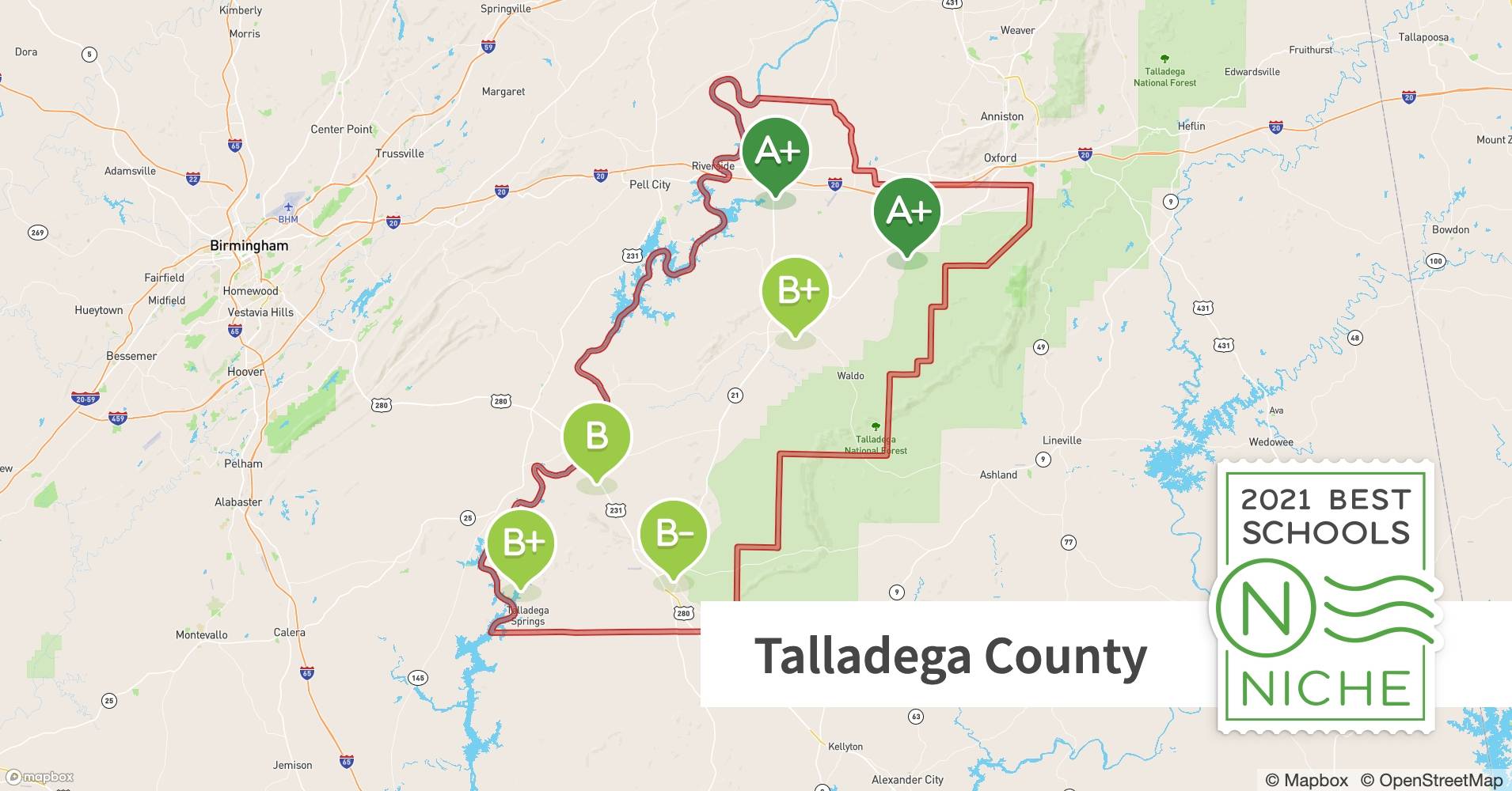
Talladega County GIS is a dynamic online platform providing access to a vast collection of property information. Think of it as a digital lens through which you can explore the county’s landscape, uncovering valuable details about land ownership, tax assessments, zoning regulations, and even environmental features. This system, powered by Keet Consulting Services’ ISV3 platform, empowers everyone from real estate agents and developers to curious residents and potential investors.
What is Talladega County GIS and Why Is It Important?
Talladega County GIS is more than just a collection of maps; it’s a powerful tool for understanding the county’s landscape and making informed decisions about property. It provides:
- Comprehensive Property Information: Access details about property lines, tax values, topography, utilities, and more.
- User-Friendly Online Platform: The ISV3 platform is designed for easy navigation and information retrieval.
- Benefits for Diverse Users: Useful for real estate professionals, developers, residents, investors, and anyone seeking property information.
- Regularly Updated Data: Ensures reliability and accuracy for informed decision-making.
Accessing Talladega County GIS: Your Step-by-Step Guide
Ready to dive in? Here’s how to access Talladega County GIS:
- Visit the Talladega County Website: Go to the official Talladega County website (talladegacountyal.org) and navigate to the Appraisal Department page.
- Find the KCS GIS Parcel Viewer: Locate the link to the KCS GIS Parcel Viewer (ISV3) (isv.kcsgis.com/al.talladega_revenue/?fips=31695). This is your gateway to the interactive map and database.
- Explore the Interactive Map: Zoom, pan, and click your way around Talladega County.
- Search for Specific Properties: Use the search bar to find properties by address, owner name, or parcel ID.
- Interpret the Data: Remember, interpreting the data is your responsibility. Consult professionals if needed.
ArcGIS: Mobile Mapping at Your Fingertips
Talladega County leverages Esri’s ArcGIS platform (arcgis.com), making GIS data accessible on smartphones and tablets. This mobile access provides on-the-go convenience for property research.
Delving into Talladega County GIS Data: Uncovering a Wealth of Information
The Talladega County GIS offers a variety of data layers beyond basic parcel information. This includes:
- Parcel Viewer: Search by address, place name, or parcel ID to access ownership details, acreage, taxes, zoning, and more.
- Tax Maps: View current property tax assessments (verify critical information with official records).
- Topographic Maps: Understand the elevation and contours of the land.
- Historic Land Surveys: Access historical property records.
- County Maps: Gain a broader perspective of the county’s layout.
- Flood Zone Data: Identify areas prone to flooding.
- Utility Locations: See the location of underground utilities.
Using Talladega County GIS: Real-World Applications
The practical uses of Talladega County GIS are vast:
- Real Estate: Agents and brokers can research properties, assess values, and inform clients.
- Development: Developers can analyze land suitability, plan infrastructure, and assess potential risks.
- Residents: Homeowners can research property lines, tax assessments, and neighborhood information.
- Investors: Investors can analyze market trends, identify opportunities, and make informed decisions.
- Government: County officials can use GIS for planning, zoning, and resource management.
Beyond the Basics: Additional GIS Resources
- Acres GIS Maps (acres.com): Provides plat maps, soil maps, elevation data, and recent sales data.
- Talladega County Economic Development Authority (TCEDA – tceda.com): Offers demographics, workforce statistics, and economic indicators.
- County Office (countyoffice.org): Compiles links to various GIS maps.
The Future of Talladega County GIS: A Dynamic Resource
Talladega County GIS is constantly evolving. Future enhancements may include 3D modeling, enhanced data visualization, and integration of new datasets, enriching the user experience and expanding analytical capabilities.
Talladega County GIS vs. Surry County GIS: A Brief Comparison
While both counties offer GIS resources, Talladega County’s recent adoption of the ISV3 platform suggests a commitment to providing a more user-friendly and technologically advanced experience. If you’re interested in exploring GIS resources in other areas, you might find the Surry County GIS or Surry County NC GIS platforms informative.
Disclaimer and Contact Information
While Talladega County strives for data accuracy, it’s important to verify critical information with official records. For questions or assistance, contact the Talladega County Appraisal Office directly.
This comprehensive guide provides a solid foundation for understanding and utilizing the power of Talladega County GIS. By exploring these resources, you’ll be well-equipped to make informed decisions about property, development, and investment in Talladega County.
- China II Review: Delicious Food & Speedy Service - April 17, 2025
- Understand Virginia’s Flag: History & Debate - April 17, 2025
- Explore Long Island’s Map: Unique Regions & Insights - April 17, 2025
