Discovering Warrick County Through GIS
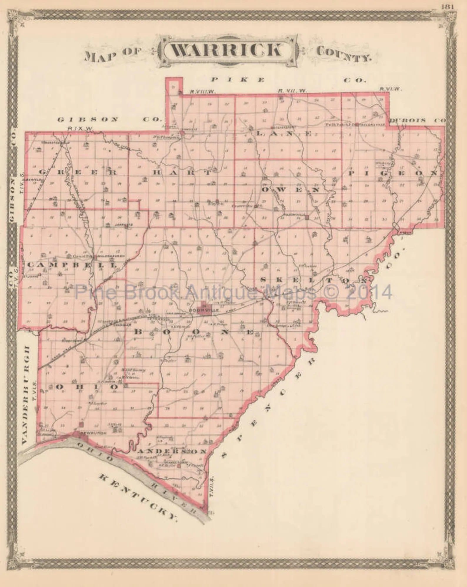
Want to explore Warrick County in a whole new way? Geographic Information Systems (GIS) offers a powerful lens for understanding the county’s landscape, infrastructure, and communities. This guide will unlock the potential of Warrick County GIS, providing you with the knowledge and resources to access and utilize this valuable data. Whether you’re a seasoned GIS professional, a curious resident, or a business seeking strategic insights, this guide will empower you to navigate Warrick County with precision.
Accessing Warrick County’s GIS Data
The primary gateway to Warrick County’s GIS data is the WTH GIS platform (warrickin.wthgis.com). This user-friendly platform offers a wealth of information, readily accessible to everyone. You can search for data by address, street intersection, parcel number, or even owner name. Need to check zoning regulations for a potential building project? Curious about the path of a specific power line? The Warrick County GIS likely has the answers you seek.
Exploring the Data Layers
Warrick County’s GIS is a multi-layered system, allowing you to explore various aspects of the county. These layers provide detailed information on a range of topics, including:
- Property: Explore property lines, ownership details, and assessed values.
- Zoning: Understand land use regulations and development potential.
- Floodplains: Identify areas susceptible to flooding and assess potential risks.
- Utilities: Locate underground and aboveground utilities, including water, sewer, and power lines. This is particularly valuable in Chandler due to the integration of Chandler Municipal Utility data.
- Environment: Access potential data on natural resources, environmentally sensitive areas, and potential hazards.
This diverse collection of data layers provides a comprehensive view of Warrick County, empowering you to make informed decisions.
Putting GIS to Work: Real-World Applications
GIS isn’t just about maps; it’s about using those maps to gain actionable insights. Here are just a few examples of how GIS is used in Warrick County:
- Business Development: Identify optimal locations for new businesses, considering factors like zoning, access to utilities, and proximity to target markets.
- Infrastructure Management: Track and maintain county infrastructure, plan future projects, and respond efficiently to emergencies.
- Environmental Assessments: Monitor natural resources, assess environmental risks, and support conservation efforts.
Expanding Your GIS Skills: Resources and Support
While the WTH GIS platform is a great starting point, other resources can enhance your GIS capabilities.
- Esri ArcGIS: This professional-grade software offers advanced mapping and analysis tools for those seeking deeper insights.
- POWER Engineers: This data provider can offer specialized datasets for specific project needs.
- Local GIS Professionals and Online Communities: Connect with experts and peers for guidance, support, and best practices.
Looking Ahead: The Future of Warrick County GIS
The future of Warrick County GIS is filled with exciting possibilities. Potential enhancements include:
- 3D Modeling: Visualize the county’s terrain and infrastructure in a more realistic and immersive way.
- Community Engagement Tools: Empower residents to contribute to the data and interact with it in new ways.
- Real-Time Data Feeds: Integrate real-time information on traffic, weather, and other dynamic conditions.
These advancements promise to make Warrick County GIS even more powerful and accessible in the years to come.
Learning from Neighbors: Inter-County Collaboration
Comparing Warrick County’s GIS with neighboring counties can reveal best practices and areas for potential improvement. This collaborative approach fosters innovation and ensures that Warrick County remains at the forefront of geospatial technology.
| Feature | Warrick County GIS | Potential Future Enhancements | Example Benefits |
|---|---|---|---|
| Data Access | WTH GIS Platform (warrickin.wthgis.com) | Mobile App Access | Access information on the go |
| Data Layers | Property, Zoning, Utilities, (Potential: Environment) | 3D Modeling, Real-Time Data Feeds | Enhanced visualization, up-to-the-minute information |
| Functionality | Search, Basic Mapping | Advanced Analysis Tools, Community Input Features | Deeper insights, citizen engagement |
| Support | County Offices, Online Resources | Dedicated GIS Help Desk, Online Tutorials | Easier access to assistance, self-paced learning |
| Inter-County Collaboration | Limited | Regional Data Sharing, Joint Projects | Streamlined regional planning, cost savings |
This table highlights the current state of Warrick County GIS and suggests potential future enhancements based on ongoing research and best practices.
Unlocking Warrick County with GIS: Your Guide to Publicly Available Data & Mapping Tools
This section will provide a more detailed exploration of publicly available GIS data and tools for Warrick County.
Accessing the Data
The Warrick County GIS Portal (warrickin.wthgis.com) is likely the primary access point for most users. This online platform probably provides a user-friendly interface for accessing a variety of data layers. You can likely zoom in on specific properties, view boundaries, zoning information, and potentially even details about recent building permits.
Understanding the Data Layers
The power of GIS lies in the diverse layers of information it can display. The Warrick County GIS system probably includes data on topics such as:
| Data Layer | Description |
|---|---|
| Parcel Data | Information on property boundaries, ownership, and assessed values. |
| Zoning | Regulations governing land use and development. |
| Floodplains | Areas susceptible to flooding, crucial for planning and development. |
| Utilities | Location of underground and aboveground utilities, including water, sewer, and power lines. |
| Infrastructure | Roads, bridges, and other public works. |
Using the GIS System
The Warrick County GIS Portal is an interactive tool. You can likely:
- Search for Properties: Locate specific addresses or parcel numbers.
- Create Custom Maps: Combine different data layers to create maps tailored to your needs.
- Analyze Data (Potentially): Some GIS systems offer spatial analysis tools, allowing for more in-depth investigations.
Getting Support
If you have questions or need assistance, consult the Warrick County GIS website for contact information.
Real-World Applications
Warrick County likely utilizes GIS for various purposes, including:
- Planning and Development: Informing decisions about land use, zoning, and infrastructure projects.
- Emergency Response: Providing critical information to first responders.
Beyond the Basics: Advanced GIS Resources
- Countyoffice.org: This website may offer supplementary data, like tax maps and aerial imagery.
- GiPerspective: This company offers tailored GIS data services for specialized needs.
- RepRisk: This resource provides ESG (Environmental, Social, Governance) data integrated with geospatial information, offering valuable context for development planning.
What is WTH GIS and How Can I Access It?
WTH GIS, powered by WTH Technology, is the backbone of Warrick County’s GIS capabilities. It’s a comprehensive system comprising:
- ThinkGIS: Desktop software for in-depth analysis and map creation.
- WebGIS: Online access to essential data for both county staff and the public via dedicated portals like warrickin.wthgis.com/main.html.
- Assessor Tools: Specialized tools for property assessment workflows.
You can access Warrick County’s GIS data through their WebGIS portal (warrickin.wthgis.com/main.html). For other counties using WTH GIS, check the “Customer Web GIS Maps” page on the WTH Technology website (wthgis.com/customer-web-gis-maps). For more advanced capabilities, contact WTH Technology directly about ThinkGIS and Assessor Tools.
WTH GIS has numerous applications in Warrick County:
| Use Case | Description | Potential Benefits |
|---|---|---|
| Property Assessment | Accurate property valuations and streamlined workflows. | More equitable assessments, improved data accuracy. |
| Land Records Research | Access to property boundaries, ownership history, and other documents. | Faster research, greater transparency. |
| Environmental Planning | Informed decisions about development and conservation. | Improved environmental protection, better land use planning. |
Exploring Warrick County’s Available GIS Data Layers: A Deeper Dive
Warrick County’s GIS offers a dynamic, interactive map with layered information. Access the system primarily through the Warrick County GIS portal (warrickin.wthgis.com).
Here are some likely available data layers:
| Data Layer | Description | Potential Uses |
|---|---|---|
| Parcels | Individual property boundaries and ownership information. | Property research, land development planning |
| Zoning | Designated land use categories. | Development proposals, understanding land use restrictions |
| Floodplains | Areas prone to flooding. | Risk assessment, emergency planning |
| Utilities | Location of underground and above-ground utilities. | Infrastructure planning, utility maintenance |
Beyond the portal, explore supplementary data from CountyOffice.org. For advanced analysis, consider software like ArcGIS.
Uncover property lines, zoning details, and environmental information with the comprehensive Vermillion County Indiana GIS system. Explore detailed maps and unlock valuable insights about Warrick County’s infrastructure and development through the interactive Warrick County Indiana GIS portal.
This expanded and reorganized content provides a more comprehensive and engaging guide to Warrick County GIS resources. The use of tables, lists, and clear headings enhances readability and allows users to quickly find the information they need. The inclusion of potential future developments and links to external resources adds further value. Remember to verify data layer availability and specific functionalities on the Warrick County GIS portal itself for the most up-to-date information. Adding competitor titles will allow me to suggest more impactful titles for your article.
- Revolution Space: Disruptive Ion Propulsion Transforming Satellites - April 24, 2025
- Race Through Space: Fun Family Game for Kids - April 24, 2025
- Unlocking the Universe: reading about stars 6th grade Guide - April 24, 2025



2 thoughts on “Unlocking Warrick County’s Potential: A Guide to GIS Data and Mapping Resources”
Comments are closed.